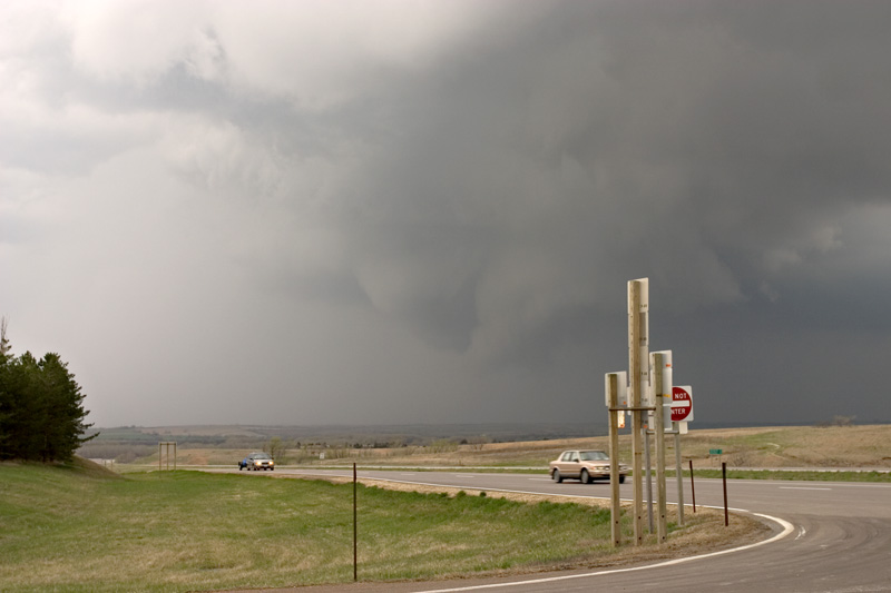
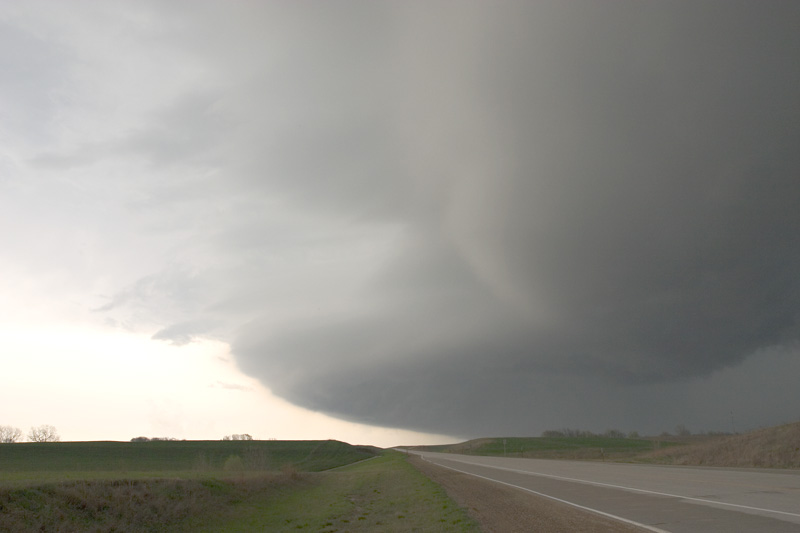
Early in the day, I spotted an area of persistent towers northwest of Manhattan, and this became the Washington County storm. It produced several sustained wall clouds with varying degrees of rotation and finally organized itself dramatically between Greenleaf and Washington, Kansas, just south of state highway 36. Mike Hollingshead and I observed this storm as it snagged a boundary—either outflow or what I analyzed as a pseudo warm front in this approximate area—and anchored itself stubbornly, with an aborted split (with precip blowing northwest onto the newborn updraft, it didn’t have much of a chance), and propagation both to the south and the southeast. The southeast updraft grew dominant and Mike and I flanked it east, and observed the very low, carousel style updraft. The feature was composed of white condensation with tendrils that articulated the circulation. We were convinced it would tornado immediately. We perched on a hill and watched the storm wrap up again—the circulation tightened to an extremely rapid motion. I was stunned that there was nothing beneath. I haven’t seen that kind of rotation from such a low feature without a tornado beneath it. This was around 21z.
We chased this storm and its various moving parts across the Nebraska
border toward Odell, where we met up with Jonathan Garner and his chase
partner. For some time, our storm had served as the intersection for a
line of convection stretching to the northeast along the cold front, and
to the southeast along the not-so-dryline advancing from the southwest.
As this angle closed, convection approached from all sides. Our storm
had no hope of uncontaminated inflow and we determined as well that we
were nearly in the center of the surface low. XM streamlines confirmed
this.
We stood outside our vehicles on a muddy dirt road, heads moving in all
directions as the cloud motions were turbulent and quick areas of
rotation appeared and disappeared. Our winds were light and northerly,
then they calmed. Then they swung around out of the east, and then from
the south, a little warmer than before. The next moment, in field of
tall and bright green vegetation about thirty yards away, a flattened
circle appeared that reminded me instantly of the crop circle hoax in
the UK. The only difference was that this circle was rotating vigorously
and racing toward us. I pointed and yelled “What the hell is that?” But
it was on us before anybody could take a guess.
Mike turned and held his open car door, both to keep it from ripping off
and to keep his feet on the ground. I crouched and turned away, gripping
the side of my 4Runner with one hand and shielding my face with the
other, as the winds blasted us with gravel and sand and tried to take us
off our feet. It was amazing! When the circulation passed, a hard
driving burst of precipitation came straight down on us for about
fifteen seconds. We estimated the wind speeds in the circulation at
between seventy and eighty knots. Mike reported a sense of
weightlessness during the event. I’m convinced that if the vegetation in
the field had been dead, it would have remained flattened.
Nobody mentioned having seen circulation in the cloud base overhead
preceding the event. However, I don’t know that I was looking up there
anymore than I was looking elsewhere—it was a ragged, cold air storm
base the likes of which we’ve all seen. It was so benign in appearance
that none of us even had our cameras out, let alone recording at the
time. However, the sequence of the wind shift and the immediate precip
is fascinating to consider. Was this a very weak tornado? I don’t know;
I’m not trying to begin a debate. It was a vigorous circulation on the
ground, that much I can say with confidence.
Soon the storms congealed into a large mess and we broke off the chase.
It was great to see Mike again and I was glad to meet Jon and his chase
partner. I thought I was in Nebraska too early last year—wow. It’s April
and there I was again. A fun and unusual chase to cap off a happy
three-day plains trip, starting with the cool get-together at the Vista
in Norman, followed by one of the best chases of my life in Kansas on
Sunday, and ending with a close encounter of the rotational kind in a
south Nebraska field. 2005 is off to a great start.
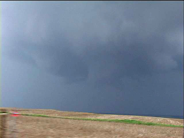
Video grabs below
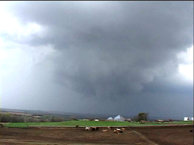
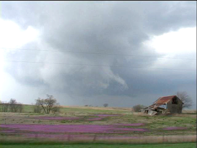
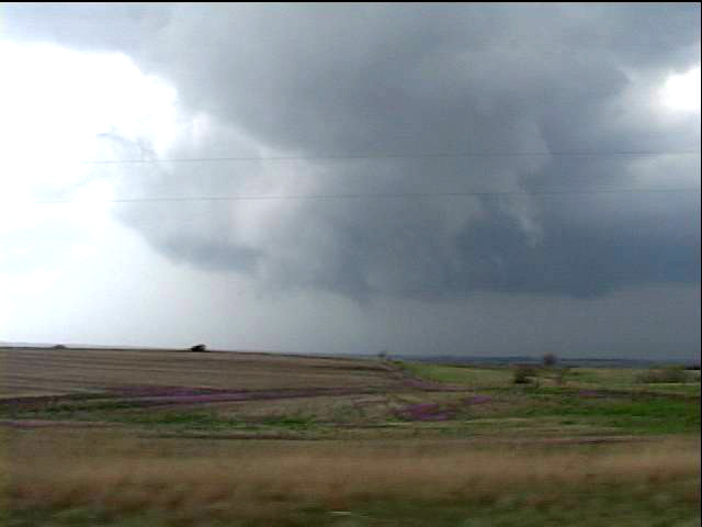
Images above from ~2030UTC eastern
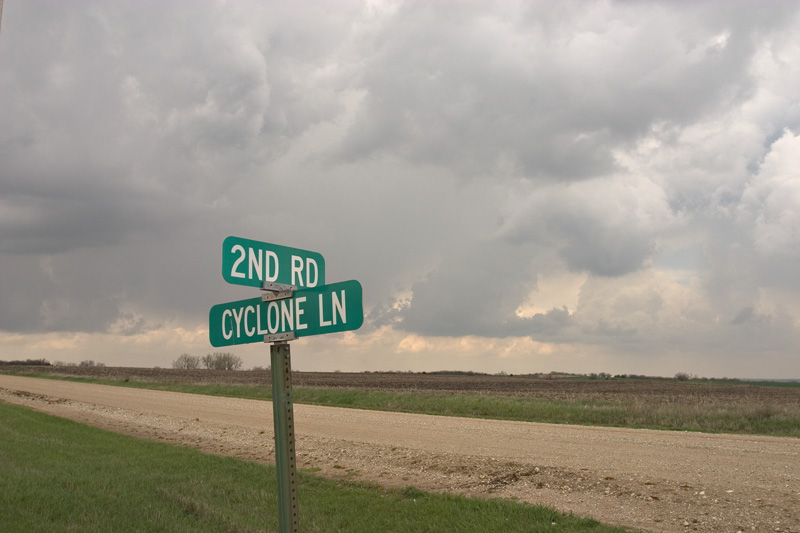
Washington County, KS, April 11, 2005