
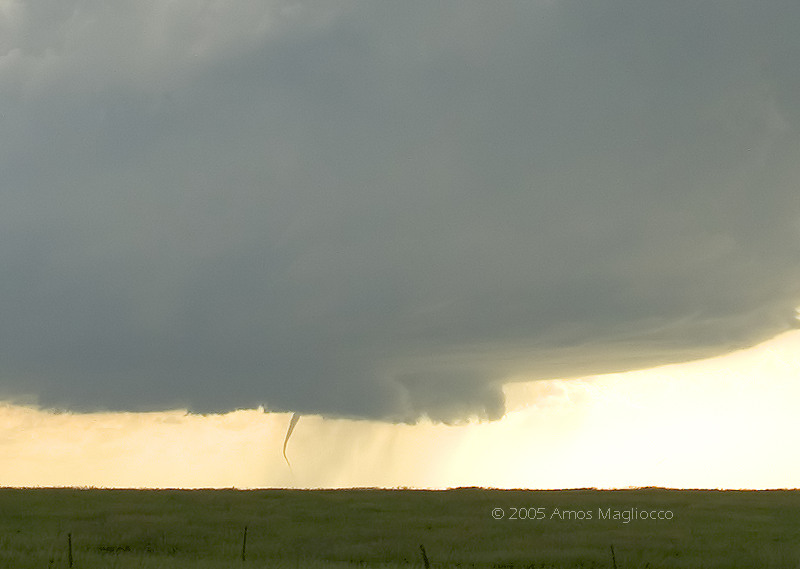
Digital stills (second image is a crop) ~2248z southwest of Wanblee, South Dakota
Digital stills (second image is a crop) ~2248z southwest of Wanblee, South Dakota
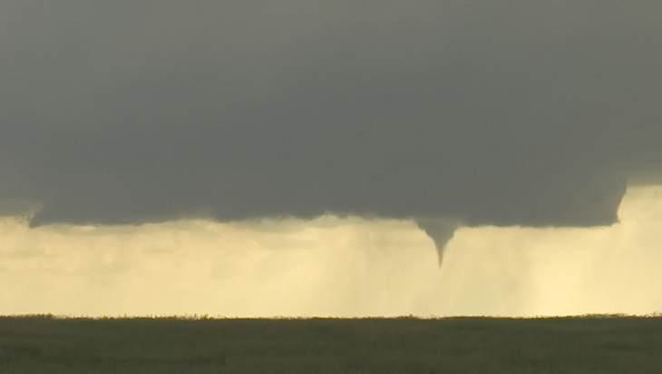
another crop from stills


Video frame grabs of snaking tornado beneath storm


Storm over Interstate 90, displaying eddies in the
striations. Fantastic rare feature!
2005 JUNE 7: JACKSON COUNTY, SOUTH DAKOTA SUPERCELL AND TORNADO
|
We observed a long-lived supercell and
associated tornado in Jackson County, South Dakota. Tornado touched down
at 2248z and lasted about seven minutes from under the base of a
gorgeous LP that was transitioning into a classic supercell. Chased this
for three hours back up to Interstate 90 where it displayed tightly
sculpted banding, including eddies in the striations which I captured in
my stills. The eddies are a more rare and remarkable phenomena than the
tornadoes. Eric Nguyen commented he hadn't seen this feature since 1998.
That was a very memorable storm for all the
presentations. A photogenic LP that transitioned into a classic (while
producing a needle tornado), to what became a fast-moving HP with
forward flank mesos and eddies in the striations. Can't ask for much
more.
|
ALL IMAGES © COPYRIGHT 2005 AMOS MAGLIOCCO / NO UNAUTHORIZED DUPLICATION
