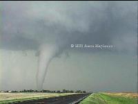
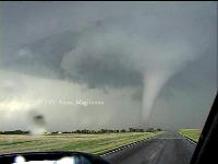
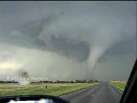
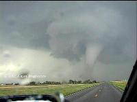
In chasing it is often better to be lucky than good, and today I was
very lucky and only good enough to avoid screwing up one of the great
chase days of the last few years. June 9 deserves a place alongside the
best chase days in recent memory, producing a wide range of violent,
photogenic tornadoes from south of Lubbock, Texas well into Nebraska.
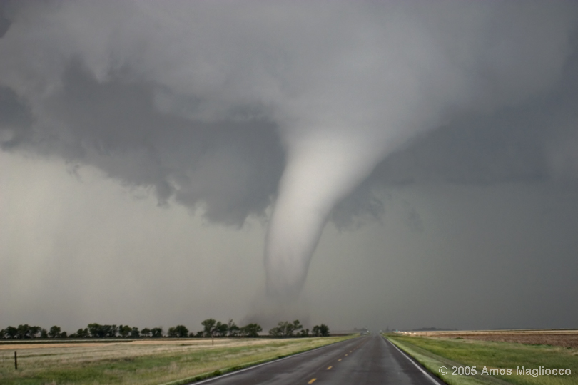
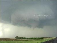
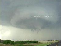
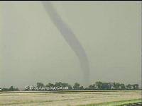
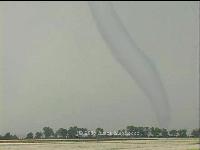
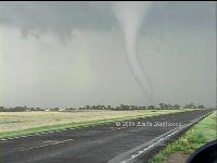
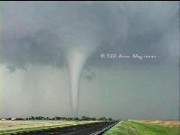
I witnessed four tornadoes from the storm that began in central Ness
County Kansas and moved into Trego County where it wound up and
developed several large cones, funnels, and stovepipe tornadoes, along
with the most violent rear flank downdraft winds I've ever seen.
 
500 mb chart from 6-10 at 0z and surface depiction
from 6-9 at 18z
A broad trough was in place over the western US and
smaller disturbances swung around this and into the central and northern
plains, including a 40 knot mid-level speed max forecast to move into
the central high plains. A front stretched from Wisconsin into
northern Kansas to a surface low in Colorado while an outflow boundary
from an earlier MCS sank southward toward the Kansas / Oklahoma border
and the Texas panhandle. A dryline also extended southward from
the Colorado low. A second outflow boundary lay draped across
northern Kansas from south of McCook to near Hill City. With
multiple lifting mechanisms and areas of extreme instability forming
south, I initially targeted the Texas panhandle where I thought a chance
for large, violent tornadoes existed in an area where the 12z RUC
forecasted >4000 j/kg MLCAPE. I believed that northern and
northwestern Kansas would also see tornadoes, but I wondered if they
might experience weaker instability, relatively speaking. I
honestly felt as if I were choosing between two excellent targets. I
targeted the southern outflow boundary for the chance at extreme
instability.
I raced south from Sterling thinking the
outflow boundary and dryline would intersect somewhere in the eastern
Texas panhandle. But the surface low in southeast Kansas was ejecting
faster than the 9z RUC model had shown, and my intersection point was
progressing steadily northward. This was a good thing, too, because
construction slowed me terribly in Colorado. If there had only been the
one storm near White Deer (which did produce a tornado, according to
several chasers), I would have been hard pressed to arrive in time.
Here are the entries to my blog as I chased this
boundary while fighting construction delays:
Posted 9:18 AM by Amos Magliocco
Racing south for Pampa, Texas area and dryline/outflow boundary
intersection. Don't know if I'll make it, but riding hard to try.
Posted 12:32 PM by Amos Magliocco
Construction on Colorado 71 southbound killed my good time. Just
arriving at Colby now. Luckily, looks like the western end of the OB
will stall in OK panhandle, so I can still make Beaver area. Headed
south after fast gas stop.
Posted 1:53 PM by Amos Magliocco
Very glad west side of OB has stalled invof DDC. Construciton on CO
71 southbound slowed me badly; TX PH target would have been
impossible. Currently 90 miles north DDC and intend to to stay just
east of OB/DL intersection. Wondering what their merger (as
mentioned in MD) further north does for lift; interesting to
consider. Much prefer idea of init on DL, movement off eastward,
then storms intersecting OB nearer maturity. So will likely play as
far south as possible to get some seperation between boundaries,
depending on DL movement of course.
I revised my target to Beaver, Oklahoma, then finally Dodge City,
Kansas. I arrived at Dodge in time for the first small storm that fired
ahead of the dry punch. At this time, the Hill City area storm was
cranking up, and I knew my friends were up there bagging tornadoes like
a shopping spree. My little cell by Dodge died rapidly, and I noticed
the storm two counties north, in Ness County, was shaping up nicely. I
hurried back up 183 and intercepted this storm about ten minutes before
it began exhibiting rapid rotation---the most violent cloud base
rotation I have ever seen. It spun and spun and I was amazed that such a
violently turning storm was not condensing or even building downward.
Then suddenly everything changed.
As the storm snagged the boundary, it began rapidly updrafting new
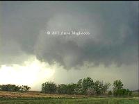
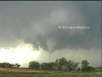
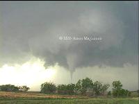
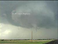
condensation, and the show was on. The first and second tornadoes are so
remarkably similar at one stage of their lives, it's nearly impossible
to tell them apart, with the perfect collar cloud orbiting each. But the
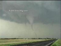
second tornado morphed into a large elephant trunk that touched down
~2300z and began to cross the road in front of me. This was about ten
miles south of Wakeeney on 283, very near Trego Center, Kansas. This
tornado was on the ground for nearly fifteen minutes. Then it lifted and
another came down--not the same funnel; clearly separate post-occlusion
tornadoes. This one began moving to the east northeast and I was behind,
since I had allowed the tornado to cross the road in front of me.
Unfortunately, my camera was zoomed all the way out and so my video
makes it look as if I was further from the tornado than I was. Not that
it matters, but it was so breathtaking that I stopped shooting digital
stills at one point and stared in awe. I like doing that once in a
while. The obsession with recording this stuff can sometimes interfere
with the actual experience. It's good to put the cameras down for a few
seconds and humble yourself before something so majestic.


2301z

2305z
I called Dodge City NWS to report the tornado (I had cell service for
once!). Then as I turned east to follow, a large RFD plume was roiling
in the field ahead of me. Then I observed an area of flattened
vegetation moving rapidly, with some of the vegetation being pulled out
of the ground and flung through the air! This was RFD--there's no
question. But it was particularly violent and I turned south to escape
and took the next east option. Strange as this sounds, that RFD was more
unnerving than any of the tornadoes, including the one not far from me.
When I rounded the corner again, a white cone tornado was still on the
ground. This was either the third tornado which had never lifted or
simply a new one. After this, a new mesocyclone to the west produced
another brief tube, and the show was over. The storm elongated and the
shear weakened. Amazing what can happen in about four hours.
Special thanks today to Eric Nguyen
and Scott Blair for
comparing notes on the forecast, and congrats to those guys for the
getting the best of BOTH storms, Hill City and Trego County. |
