
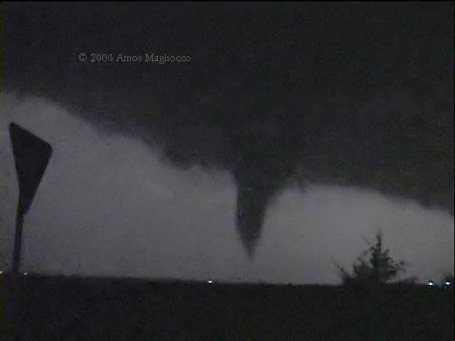
Violent tornado approaching Westminster, Texas May 9, 2005

Tornado approaching Westminster, Texas ~0337z. This tornado was
responsible for three deaths in Westminster. The light in the foreground
is not a power flash but an ambient stationary light source.
A storm in north central Texas produced three tornadoes tonight that I observed along with Eric Nguyen and Scott Eubanks. The first tornado was four miles east of Gunter, Texas in southern Grayson County around 0210z. The second tornado was northeast of Anna by less than one mile at around 0329z and then the third, forming about five minutes later, was approximately seven miles east northeast of Anna around 0337z. We saw the latter tornadoes after having met up with James Clarke.
We originally targeted the intersection of the cold front and outflow boundary in central Oklahoma and spent much of the day hoping CI would occur in more chaseable terrain. When it became clear that wasn't happening, we headed home for DFW with only the slimmest idea that something would fire south of the river along the front. We were south of Gainesville when the storm went up, and, observing the dramatic signs of an explosive updraft, we turned around to chase. We weren't aware of any boundaries in the Red River Valley, but knew the dewpoints were high and expected that something around 4000 j/kg still existed in the region.
When we turned back north to chase it, the backsheared anvil was dramatic, with a strongly knuckled appearance and extreme bulges on the underside. A flanking line was exploding in a small row, presumably down the cold front. I have stills of all this which I'll post over the next few days.
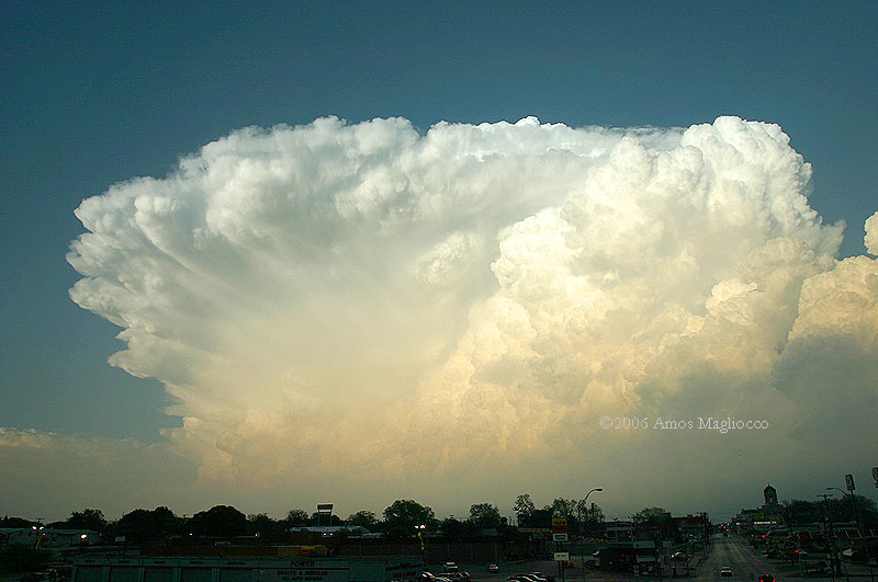
Explosive updraft as we approach the storm from
the west
When we reached the storm, however, it had a linear
presentation and no obviously dominant updraft base. We speculated if
such a multi-cellular segment could even support a RFB. We dropped south
where a new core seemed more promising and found a base for it, a large,
smooth, bowl shaped lowering west northwest of Gunter. Eventually this
produced the first, mostly-unknown tornado around 9:10 PM. We were
unable to report this until about twenty minutes later. After this
tornado lifted, the storm organized and became isolated, and the updraft
evolved a more striated appearance. However the tornado potential looked
slim and we noted some cool outflow in places.
We were actually surprised when the warning came at 0308z. I have not
had time today to study a radar loop, but my guess is that between 0245z
and 0300z, the rotation developed higher in the storm and strengthened.
It's interesting to consider why and how given the seemingly marginal
difference in the environments.
It is upsetting to read tonight that our last tornado, a wedge during
its most powerful stage, killed three people in Westminster. Both myself
and Sam Barricklow (K5KJ) along with a few other spotters were in
constant communication with the Colin County Skywarn and NWS was aware
of this tornado well before it reached the small community ten miles
northeast of McKinney. However if Westminster didn't have sirens or if
this family wasn't tuned to local media or NOAA radio, they might never
have received warning. I think I can speak for the other guys when I say
this news negates our enthusiasm for tonight's observations.
The National Weather Service in Fort Worth has a
web page dedicated
to this event, including pictures, maps, and other information.

~4 miles east of Gunter in southern Grayson
County, Texas ~0210z (favorable lightning created the good illumination)

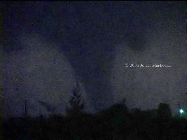
Tornado northeast of Anna, Texas by one mile ~0329z

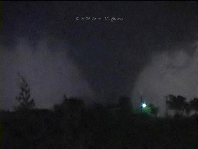
Between Anna and Westminster

All imagery © 2006 Amos Magliocco